


Search Images
You can search the photo archives of the Alberta Aviation Museum by entering keywords into the box below. You can also select to browse images a particular category or images by selecting a category or "Browse All Images" link below.
Example: bush pilot
| Select a category from the list below. | |
| Planes | People |
| Artifacts | Archival Documents |
| Photographs | Pilots |
| Military | Commercial |
| WW 1 | WW 2 |
|
Page 11 of 13 << Back 1 | 2 | 3 | 4 | 5 | 6 | 7 | 8 | 9 | 10 | 11 | 12 | 13 Next >> |
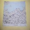 | Map A relief map of Gulf of Danzig, Scandinavia Area, map #169. Prepared and printed by the Army map Service (AM), Corp of Engineers, U.S. Army, Washington, DC from G.S.G.S. 2578, 1:1,000,000 maps dated 1944 and 1945. British Crown Copyright Reserved. Reproduced with the permission of Her Britannic Majesty's Stationery Office. |
 | Map A relief map of Neman River, Scandinavia Area, map #168. Map was prepared and printed by the Army Map Service (AM), Corp of Engineers, U.S. Army, Washington, DC from G.S.G.S. 2758, 1:1,000,000 maps dated 1947 and 1948. British Crown Copyright Reserved. Reproduced with the permission of Her Britannic Majesty's Stationery Service. Scale 1:1,000,000. |
 | Map A relief map of Western Russia including the cities of Smolensk, Moscow and Bryansk. Map prepared by the Army Map Service (AM), Corp of Engineers, U.S. Army, Washington, DC from G.S.G.S. 2758 1:1,000,000 maps dated 19847 and 1948. British Crown Copyright Reserved. Reproduced with the permission of Her Britannic Majesty's Stationery Office. |
 | Map A relief map of Land's End, Central Southern Europe, map #229. Printed by the Army Map Service, Corp of Engineers. All other information has been cut off this map. |
 | Map A relief map of the Strait of Dover, Central Southern Europe, map #230. Map was prepared and printed by the Army Map Service (AM), Corps of Engineers, U.S. Army, Washington, DC. Reprinted and molded in 1958 from G.S.G.S. 2758 1:1,000,000 maps dated 1945 - 1946. British Crown Copyright Reserved. Reproduced with the permission of Her Britannic Majesty's Stationery Office. Horizontal Scale 1:1,000,000; Vertical Scale 1:250,000 and Vertical Exaggeration 4:1. |
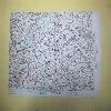 | Map A relief map of B÷hmer Forest, Central Southern Europe, map #231. Printed and prepared by the Army Map Service (AM), Corp of Engineers, U. S. Army, Washington, DC. Constructed and molded in 1950 from G.S.G.S. 2758, 1:1,000,000 maps dated 1945 - 1946. British Crown Copyright Reserved. Reproduced with the permission of Her Britannic Majesty's Stationery Office. Horizontal Scale 1:1,000,000; Vertical Scale 1:250,000 and Vertical Exaggeration 4:1. |
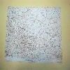 | Map A relief map of Central Carpathians, Central Southern Europe, map #232. Map prepared and printed by the Army Map Service (AM), Corp of Engineers, U.S. Army, Washington, DC. Reprinted and molded in 1957 from G.S.G.S 2758, 1:1,000,000 maps dated 1945 - 1946. British Crown Copyright Reserved. Reproduced with the permission of Her Britannic Majesty's Stationery Office. Horizontal Scale 1:1,000,000; Vertical Scale 1:250,000 and Vertical Exaggeration 4:1. |
 | Map A relief map of the Loire River, Central Southern Europe map #254. Map was prepared and printed by the Army Map Service (AM) from G.S.G.S 2758m 1:1,000,000 maps dated 1945 - 1946. British Crown Copyright Reserved. Reproduced with the permission of Her Britannic Majesty's Stationery Office. Horizontal Scale 1:1,000,000; Vertical Scale 1:250,000 and Vertical Exaggeration 4:1. |
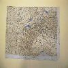 | Map A relief map of the Lake of Geneva, Central Southern Europe, map #253. Map was prepared and printed by the Army Map Service (AM), Corp of Engineers, U.S. Army, Washington, DC. Reprinted and molded in 1961 from G.S.G.S. 2758, 1:1,000,000 maps dated 1945 - 1946. British Crown copyright Reserved. Reproduced with the permission of Her Britannic Majesty's Stationery Office. Horizontal Scales 1:1,000,000; Vertical Scale 1:250,000 and the Vertical Exaggeration 4:1. |
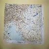 | Map A relief map of the Gulf of Venice, Central Southern Europe, map #252. Map was prepared and reprinted by the Army Map Service (AM), Corp of Engineers, U.S. Army, Washington, DC. Reprinted and molded in 1960 from G.S.G.S. 2758, 1:1,000,000 maps dated 1945 - 1946. British Crown Copyright Reserved. Reproduced with the permission of Her Britannic Majesty's Stationery Office. Horizontal Scales 1:1,000,000; Vertical Scale 1:250,000 and the Vertical Exaggeration 4:1. |
<< Back 1 | 2 | 3 | 4 | 5 | 6 | 7 | 8 | 9 | 10 | 11 | 12 | 13 Next >>
